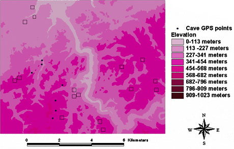
Are the Caves Really Out There?
The eight-day reconnaissance mission in the Macal Valley should provide sufficient ground-truthing data on the locations that we identified in our previous research. All of the 16 possible sinkholes we found have coordinate information. We plan to use a hand-held GPS receiver and topographic maps of Belize to pinpoint the sinkhole locations, plot a course for the sites, and, hopefully, to find caves on the ground. If we locate actual sinkholes, we'll conduct archaeological investigations inside.
It is not guaranteed that the features that we have identified as "sinkholes" will turn out to be sinkholes. Some may just be low depressions in the ground. Even if we find true sinkholes, they may not have been used by the ancient Maya.
Our investigations in this phase of the remote-sensing project will help determine whether the Star3i RADAR data is useful for locating sinkhole features. If we are successful, our results will be included in a proposal to obtain other remote-sensing images from
various platforms to diversify our investigations.
Click here for the expedition!


