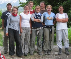
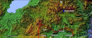
The aims of the territorial archaeological survey of 2009 were to explore more systematically and in more detail the western part of the valley of BaÄŸsaray, between the villages of Kayış, Ovacık, and BaÄŸsaray. This region constitutes the southernmost section of the ancient territory of Sagalassos. To that purpose a number of earlier visited sites was reexplored. These were the site of Kale (Ovacık/Kayış), Çatal Pınar and Demirli. This year’s survey team was assisted by Mehmet Katkat, from the Eskisehir Museum.
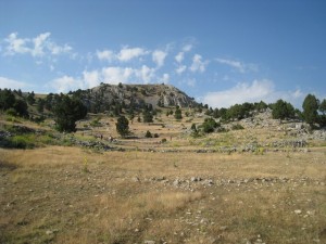
The site of Kale (Ovacık/Kayış) occupies the top and the southern slopes of the mountain range separating the small basin of Ovacık from the large basin of Bağsaray. The site offers wide views on the surrounding area, and was clearly in use because of this strategic advantage. The Kale itself was fortified (big limestone blocks) over much of its circuit, except in those parts which were protected by nature. Lower down the slopes, several secondary lines of defence were established. Over a surface of ca. 22 ha, the remains of numerous small buildings in dry rubble were recorded. These were not associated with tiles. The ceramic assemblage of the site includes primarily Early Iron Age to (early) Hellenistic sherds. The site (esp. its highest parts) was sporadically in use during the Roman and Byzantine period.
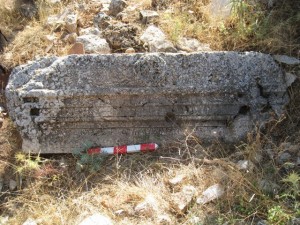
The site of Çatal Pınar is located on the other side of the same mountain range. The higher and middle slopes are literally covered with pottery. At first sight, the pottery ranges from Hellenistic/Roman to Byzantine/Selçuk date. The remains of at least one church were discovered, and the probable remains of a second one seem to overlay a Roman temple. Much of the surface remains seem to be related to sepulchral uses (human bone fragments, glass bracelets, the remains of at least one in situ tile grave). However, the site clearly was a settlement, as is shown by the broad range of pottery shapes, and was obviously involved in the cultivation of olives (cf. three olive presses). At the moment it is difficult to separate the possibly different functions the site had during subsequent chronological phases. Preliminary, it seems that we are dealing with a Roman settlement, followed by a (early) Byzantine use of the site, during which period at least one church was erected (cf. inscription by a deacon called Zosimos, who dedicated a door to a church, the apsis of which was found in situ nearby). During Byzantine/Selçuk times, it seems that a small settlement was installed here, with a necropolis. The Kale at that time, and possibly also earlier, was also re-occupied, and possibly served as a refuge for the settlement.
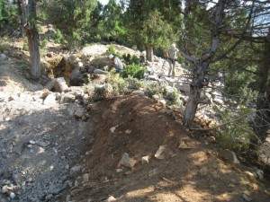
Demirli is a secluded yayla, located north of the road from Bağsaray to Akyayla, about 6 km west of the former village. The site consists of a number of wide meadows, fed by several springs, and is surrounded by pine-clad hills. The ruins of several dozens of buildings can be noticed on the surface, surrounding the meadows. Some of these were furnished with ashlars and more elaborate architectural fragments (columns, benches, doorlintels,…). These structures are clearly the remains of several Roman monumental tombs, built in ashlar and fieldstones and embellished with columns, architraves, etc. A fragment of a statue of a woman was also recorded. Three olive press weights were noticed as well, indicating the economic basis of the settlement. However, purely residential structures could not (yet) be distinguished. They are possibly located higher on the slopes. However, visibility here is minimal and only few sherds could be collected.
In three weeks time the known sites and their wider surroundings in this part of Sagalassos’ territory were explored. A preliminary interpretation of the finds allows to draw parallels with the Bereket area surveyed last year. The earliest evidence for the 2009 survey season goes back to the Early Iron Age (ca. 1000-600 B.C.), at the time when a substantial community occupied the northern slopes of the Kale at Ovacık/Kayış. At some point during the Classical-Hellenistic period (ca. 500-200 B.C.), as in the Bereket area, the need for superb strategic site locations evaporated gradually, and the new focus of settlement was nearer the valleys, on the southern slopes of the Kale, where a new community was established at Çatal Pınar. This settlement remained the major nucleus throughout the next centuries (ca. 200 B.C.-A.D. 1300). It was joined, in Roman times by an exclusive community of Roman landowners who were buried near their estates, at Demirli. Olive cultivation must have constituted one of the pillars of the economic basis of these communities. Unfortunately, no pollen diagrams are available for this region, so it is unclear what other crops were grown in the area, or when intensive cultivation came to an end. What is clear, however, is that during the Byzantine/Selçuk period (ca. A.D. 800-1300) Çatal Pınar remained in use, as a settlement with its own necropolis. The later fate of this community is as yet unclear.
Another, more practical outcome, of this year’s surveys is the small excavation which is planned at Demirli. This is the result of severe damage to some of the tombs by grave robbers. In fact, one of the tombs has been so thoroughly “investigated†by them that it cannot be left as it is. For that reason a short excavation by the Museum of Burdur will take place later in August to clear the debris and draw the tomb’s plan.


I just wanted you to know that I look at your website each day for the last few years. I think it is great. I live in Westbrook Connecticut and wish we had these ruins over here.
Seen your group photo, and have to say if I had known such attractive women would become archeologists, I’d have signed up a long time ago.
@ previous post: Indeed, I have to agree it is often not easy to spend one or two months with these surveyors. And the lack of privacy is killing me/us too 😉 By the way, for more daily life pictures of these and other project members, feel free to drop by on the Sagalassos project’s main website.
Surveyors are generally known to be full of energy and always in good spirit. And yes, they are often a burden on the more placid archaeologists 🙂
Joeri: headings of the pictures of Çatal Pınar and Demirli should be swapped! Underneath the ruins it should read Demirli, underneath the inscribed architrave Çatal Pınar
Thanks for calling me a placid archaeologist, Hannelore. I feel so honoured now… and I miss you. I’ll ask Amelie to make the changes in the report as you have asked. She is webmastering this site, but it was my mistake nonetheless.
I visited this city ruins several years ago after I completed my military service in Burdur and enjoy your site very much. I just stumbled across it today. Keep up the good work! I hope to be able to visit one day again in the future, inshallah, and I am excited about the progress and continued success of your efforts.